| 1 results of 1 | Open Now |
Map of Goulburn Weir, VIC 3608
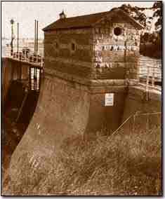
Goulburn Weir is a weir built between 1887 and early 1891 across the Goulburn River near Nagambie, Victoria, Australia. It was the first major diversion structure built for irrigation development in Australia. The weir also forms Lake Nagambie where rowing regattas and waterskiing tournaments are held.
The Goulburn Weir allows water to be diverted by gravity via the Stuart Murray Canal and Cattanach Canal for off-river storage in the Waranga basin, for later use in irrigation.
The weir is 209 metres long by about 16 metres high. Its design was considered very advanced for its time, so much so that it featured on the back of half-sovereign and ten-shilling notes from 1913 to 1933, including on the first Australian banknote ever issued. The structure also contained one of the first hydro-electric turbines in the southern hemisphere, used to supply power for lifting and lighting.
After more than 90 years of continuous service, many of the weir's components were in urgent need of replacement. Stabilisation works were done in 1983 and in 1987.
The weir raises the level of the Goulburn River so that water can be diverted, by gravity, along the main irrigation supply channels: Stuart Murray Canal, Cattanach Canal, East Goulburn Main Channel. The weir services nearby farming of crops including wheat, stock and domestic supplies.
Popular
Businesses
Streets
Popular businesses & services in Goulburn Weir
Businesses and services in Goulburn Weir starting with J
My Whereis
Home
Set home locationWork
Set work locationSet your home and work address and access your most frequently used addresses easily.
Get quotes from your local Australian Businesses
| Our new tool powered by |
Results
Close